Last updated on September 8th, 2023 at 04:25 pm
The damage and loss of people by the river or coastal erosion in Bangladesh are estimated at 36,406.92 million takas. The crops 1076.20, livestock 729.30, poultry 33.90, fishery 338.72, land 31742.12, house 2034.28 while homesteads and forestry 454.40 million takas, which is 19.76 per cent of the total. 215,702 households were affected by coastal erosion. From 2009-to 2014, 105,925 acres of land have been damaged by coastal erosion, which is the number one cause of land damage, making flood and salinity second and third. Of the 81,8137 affected households, 35,585 are from the Barishal division alone, according to Bangladesh Disaster-related 2015, Climate Change and Natural Disaster Perspective.
Beautiful Bangladesh
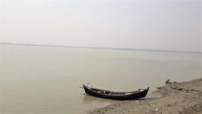
Beautiful Bangladesh. Part of Hatia Island of Noakhali.
I have recently travelled to the coastal islands of the Barishal division. Beginning from Chittagong city, we had to reach the city of Barishal via the Noakhali district to Hatia Island to Nijum Island to Monpura Island to Charfession Island to the Barishal divisional city. From the city, we returned to Chittagong via Chandpur.

During the four days of the journey, we travelled to four offshore Islands of the Barishal division. Most of the time travelling between the Islands had to be done by trawler or launch. Even though, the islanders have different forms of movement, including rickshaws, motorcycles, bicycles, jeeps and tom-tom or three-wheelers and buses. Hatia Island has motorcycles and CNGs, while the motorcycle is the only means of transportation inside Nijum Dwip or Silent Island.
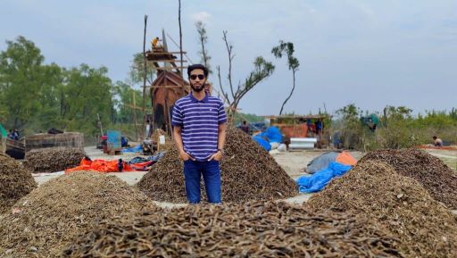
Emerged in the 1950s and came under the human settlement in 1969, the Island is a cluster of Islands comprised of twenty kilometres of sandy beaches. Afforestation of the Island started right after Bangladesh’s independence, in 1972 with mangrove species. It is a virgin island due to the estuary of the Meghna river and the Bay of Bengal constituted of intertidal mudflats and sandflats. The fishermen dry their catches on the grass which they say reaches different cities and industries for human consumption or producing poultry feed.

The island is crisscrossed by many small creeks or canals and its central part is under cultivation and human habitation. The main attraction of the island is the herd of 5000 spotted dear. Former minister of Bangladesh, Amirul Islam Kalam, named the Island Nijum Dwip or Nijum Island, observing its isolation and mild nature, in 1975. Along with monkeys, wild boar, wild buffaloes, fishing cats, snakes, turtles, tortoises, Bengal monitor, black lizard, yellow monitor, oriental small-clawed otters, clawless otters and a huge number of migrated winter birds, Oysters of various nature and snails can be easily seen in this island.
There is a large breeding colony of black-crowned night-heron, pond heron, grey heron, purple heron, cattle egret, little egret, lesser whistling-duck, bar-headed goose, cotton pygmy-goose, common shelduck, ruddy shelduck, tufted duck, water cock, and a wide variety of shorebirds, ring-billed gull, herring gull, noisy gull, sea terns, hawks, swallows, falcons, small cranes, local nightingales and king storks.

The ‘Team-Roaming-Bangladesh’ in the Island of Charfession of Barishal division.
But the global climate change effects such as sea-level rise, natural calamities like cyclones, rise in temperature and salinity will have a direct influence on the island. The wonderful mangrove forest may be affected by climate change in the near future. According to the report, that within 60 years the mangrove forests will be inundated by the rising sea level and by 2070 it may rise 11.2 inches causing a 96 per cent shrinkage of Njum Island.
On 19 February, early in the morning, we headed for another Island, the Island of Monpura of Bhola districts in the Barishal division. With 373.19 square kilometres, the island is surrounded by the river Meghna. It has a small beach created by the sediment from the river Meghna. Even though we could not visit the whole island of Monpura, we must say it’s an island full of beauty all around.
On the same day, we journeyed to the Island of Charfession. It has a Wildlife Sanctuary located on an island in the Bay of Bengal. As tradition goes, the people started inhibition around 1930 here on the Island. The well-planned and handsome city of Charfession kept bemused me. However, the next morning we headed for Patuakhili district to be on the Kuakata sea beach.
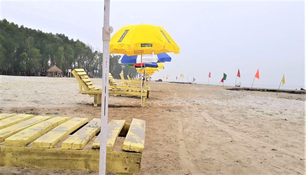
Kuakata is a wide sandy beach where visitors can experience the sunrise and sunset. Known as Shagor Konna or the daughter of the sea, Kuakata beach is 30 kilometres long and 6 kilometres wide. The name Kuakata originated from the word ‘Kua’ for “Well” which was dug on the seashore by the early Rakhine settlers in quest of collecting drinking water. After being expelled from Arakan by the Mughals in the eighteenth century they began a settlement on the coast of Kuakata. A Rakhine hamlet is there in the neighbourhood.
We returned to Chittagong on 22 February from Barishal city by the launch via Chandpur of Noakhali districts in the Chittagong division. The picturization of the beauty of the islands, the simple and hard-working lifestyle of the locals, the sympathetic attitude of the people, the constant struggle of the islanders against natural calamities like a cyclone or land erosion, the dazzling camaraderie between human and nature, kept me infatuated.
My feeling of being fortunate to be able to observe the real struggle of islanders against the effects of climate change broke my heart even greater degree. Let us take into consideration what fate might befall the islands, islanders and the beauty of them.

Climate change and coastal erosion in Bangladesh
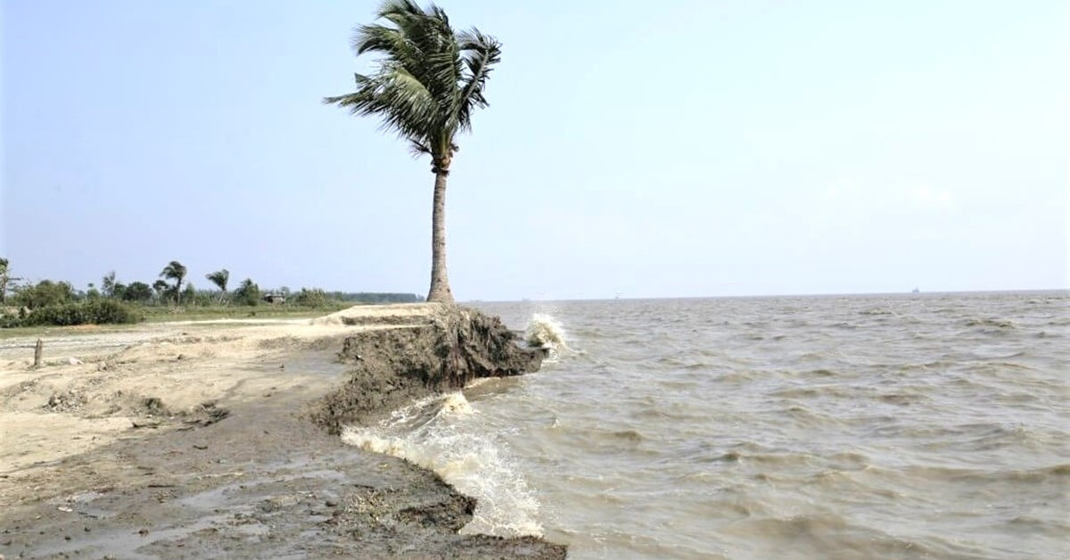
Climate change is the greatest threat to the mankind now. Bangladesh has been identified by scientists as one of the most vulnerable and potentially one of the most severely impacted countries by climate change including extreme weather events. The influence of climate change is obvious in the river or coastal erosion, which is thoroughly a heart-breaking event.
It is beyond doubt unbearable to witness how people are being victims of climate change. Low-income or cultivation-dependent people are the biggest victims as the rich ones get settled in the urban areas. I was stunned to see how people are helplessly giving up fighting against the forces of nature. Helpless, they can only rely on the mercy of nature for everything from livelihood to inhabitation.
Even though islanders were seen to accept the decision of nature, I cannot imagine how easily they are getting used to losing the homestead they were born and brought up. The land property, which provides them with subsistence, the vegetation that was there for generations are being gradually washed away, being disappeared into the mighty torrents of the rivers. The grazing space is getting smaller every moment. The amount of arable land is getting smaller. Food production is decreasing. The rivers are losing their depth.
The research has identified a set of twelve vulnerabilities in various areas in Bangladesh. These are 1) Sea Level Rise 2) Cyclone (Intensity & Frequency) 3) Deeper Penetration of Saline Water 4) Erratic Rainfall 5) Flood (Intensity & Frequency) 6) Drought 7) River Bank Erosion 8) Health 9) Food Security 10) Water Security 11) Landslide in CHT and 12) Migration.
Of all river banks or coastal erosion is a regular phenomenon in Bangladesh. According to CEGIS, 88,780 hectares of land had been eroded along the Brahmaputra, 27,990 hectares along with the Padma and 38, 510 hectares along their distributaries between 1973 and 2007. About 15 to 20 million people are at risk of river erosion. Nasa Earth Observatory reports losing 66,000 hectares of land to the Padma, since 1967.
Owing to the largest delta, with more than 230 rivers, in the world formed by the mighty rivers namely the Padma (the Ganges), the Brahmaputra, the Karnafuly, the Jamuna, the Meghna, the Dhaleswari, and the Gamoti etc., Bangladesh has an area of 147,470 square kilometres supporting about 158.90 (now 164 million) million people with a population density of 1,077 per square kilometre. About 80% of the country is a floodplain, 12% is hills, and about 8% is terrace or uplifted blocks. Bangladesh currently has 19,467 square kilometres of marine area.
According to the Bangladesh Environmental Statistics Framework (BESF) 2016-2030, Bangladesh is ranked by World Risk Report 2016 as the 6th most natural disaster-prone country out of 173 countries in the world. The different meteorological, hydrological and geological hazards often lead to disasters and the major ones in the country are floods, cyclones, droughts, tidal surges, tornadoes, earthquakes, river erosion, infrastructure collapse, waterlogging, water and soil salinity, epidemic, and various forms of pollution etc.
Due to the fast-changing global climate, frequent weather-related extreme events such as cyclones, floods, tornados, thunderstorms, droughts, heat stress, wildfires etc. have affected all parts of the world.
Natural calamities bring various forms of illnesses to the people of the Islands. Flood is the primary cause of sickness of people in the coastal area. Of the 189,0734 cases, 905,781 cases, which is 47.91 per cent, are caused by flood while coastal erosion caused 0.85 of sicknesses. Due to erosion, 4.16 per cent of people were injured, causing 143,973 non-working days making 16.86 per cent per household.
Hard Realisations: The poor and the Nature
Being in nature and poor people causes me to introspect some vital prospects of life:
- 1. Poor people are not in fact greedy. I think because once they rely on nature for subsistence, they are not deprived of it. They do not have the tendency of accumulating wealth beyond necessity. Therefore, they seem happy, healthy and uncomplicated. The complication in life starts when we try to accumulate more than what we need. Greed takes place when we aggregate as much as possible not considering others. By nature, the poor are much more resilient to natural calamities than the rich. The rich and educated urban are the ones to pollute and destroy nature.
- 2. The enmity between poor and rich seems more obvious. I think poor people’s hatred toward the rich is because of the latter’s unusual display of their richness when the former struggle to meet their end meals. To be loved by the poor, making oneself down-to-earth is undoubtedly a broadmindedness.
- 3. The poor people sustain and preserve nature, but the rich people have appropriated it in order to build an empire and display supremacy and dominance over the weak. Instead of preserving, protecting and promoting nature, the rich entertain visitation to nature as a form of luxury. A luxury that is unaffordable for the middle-class. The rural people preserve it in order to sustain life; the urban enjoy it in a view to prolong it. The rural protect it while the urban enjoy destroying it. The rural rely on nature, the urban on the other hand on the industries.
- 4. Sex is objectified not by the poor or the rural people, but by the rich and hybrid generations of the urban setting. Sex, for the poor, is just a way of maintaining generation and procreation. The urban found sex another form of recreation, while for the poor recreation is fulfilling the demands of nature and maintaining the natural disciplinary boundary. Numerous urban products are aimed at sex and physical attractiveness, while everything of nature is to nourish and maintain the generations next of all the species.
Conclusion
Having all said, Bangladesh is full of wonderful places to be in, most of which are still out of the reach of so-called development aiming at urbanisation. So-called because the current trend of development through relentless urbanisation and globalisation has become somewhat of the criterion of class distinction.
The development that destroys nature; promotes concrete structure; advocates industrialisation; inspires materialism, science over humanity, dependency on industrial products, objectification of sex and human feelings; causes class consciousness based on education and wealth; changed beauty perception based on skin colour; teaches accumulation of wealth through competition is nothing but a pure motive to the self-destruction of humankind.
Humanity have only 78 years and 308 days left till the end of rainforests, by 2100 there will be no more rainforest left.
If we fail to teach the educated human minds to promote and preserve nature the cost of the failure would be too heavy to bear for the urban reaches. Our failure will cause us to wait for us to witness more epidemics, incurable diseases, more homeless people, less fish to eat, less land to produce food, less humanity but more concrete structures to bury ourselves alive.
Theworldcounts.com records that in 2015, an estimated 50 per cent of the planet’s wild forests had gone since its destruction continued. If the trend is not stopped, we will only have 10 per cent of the world’s original forests left by 2030 and we have only 78 years and 308 days left till the end of rain forests, by 2100 there will be no more rainforest left. Act now, and save the world, and save humanity.


Does the Government of Bangladesh have plans to protect the shores and river beds from erosion. Or, let me put it this way, ‘is there global intervention or support [[material or financial] to take appropriate steps to prevent and protect’.
Happy to know that the Bangladesh government formulated the Climate Change Trust and the Ministry of Climate Change to tackle climate change-related hazards. But soil erosion, riverbank erosion or land erosion phenomena are inevitable and beyond the purview of the government. The level of erosion is so forceful that it can not be controlled by mere project formulations. It is the ultimate effect of climate change and environmental pollution. Grateful for dropping your comment.